


Tweed Sand Bypassing app for iPhone and iPad
Developer: CoastalCOMS
First release : 08 Mar 2017
App size: 16.36 Mb
The Tweed Sand Bypassing app provides key information and resources on the joint sand delivery project between the NSW and Queensland State Governments. The system is made up of a fixed jetty which is located at Letitia Spit, with the occasional use of a floating dredge. Through restoring the natural coastal drift and improving boating access to the Tweed River, Tweed Sand Bypassing manages the role of sand in our coastal lifestyles.
Features and resources include:
- Sand Delivery
Find out the latest information on where and how much sand has been pumped in the last 24 hours. Click through to a map highlighting the pathway used. On occasion when dredging is required, the quantity and location of the deposited sand is also available.
- Entrance Conditions
View the most recent Tweed River entrance condition map. Updated every 3 months, this helps show the movement of sand around the Tweed Bar.
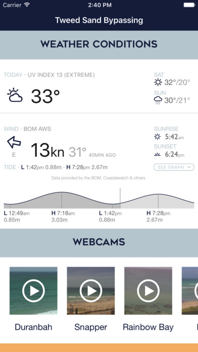
- Weather Conditions
Using up-to-date BoM data, view the current weather conditions including forecasts, winds and tides.
- Live Wave Buoy
View data streamed from Tweed Sand Bypassing’s very own wave buoy located offshore of Letitia Spit. This provides access to the live swell and wave conditions.
- Webcams
Live video streams from Coastalwatch show the current beach and surf conditions at four locations; Duranbah, Snapper, Rainbow Bay and Kirra.
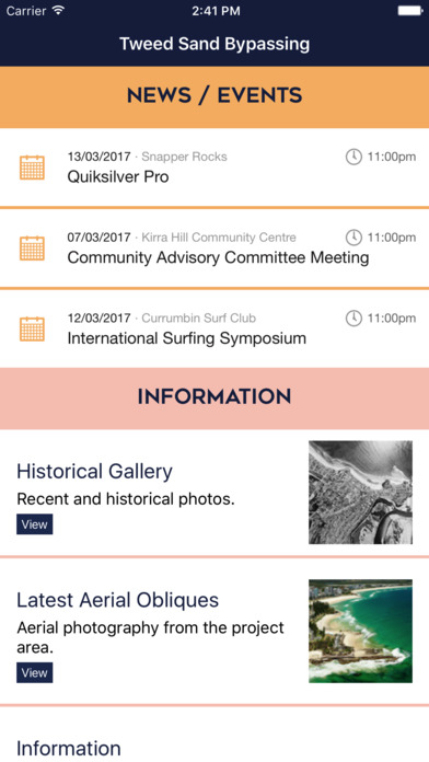
- News and Events
Details on the latest news and upcoming events related to Tweed Sand Bypassing including Project community meetings.
- Information
Click through to view current and historical photo galleries, Tweed Sand Bypassing’s publication ‘Sand’, the Project video and more.